
W Go-Kart Osaka publishes two Osaka go kart route specifications. The Castle loop is approximately 12.6 kilometres and 48 mapped minutes, with a daytime recommendation. The Tsutenkaku city loop is approximately 8.9 kilometres and 46 mapped minutes, with a night recommendation and a map passing through or near Amerikamura, Shinsaibashi, Dotonbori, Namba/Nipponbashi, Ebisucho and Shinsekai. Both are guide-led, approximately one-hour loops from Shinmachi.
Those facts are enough to select a route identity, but not enough to calculate speed, exact finish, stop count or visibility. A careful buyer separates three types of information: values published by the operator, simple arithmetic derived from those values, and details the site does not state. This article keeps those boundaries explicit.
The Osaka go kart route data sheet starts with five fields
| Published field | Castle loop | Tsutenkaku city loop |
|---|---|---|
| Map distance | Approximately 12.6 km | Approximately 8.9 km |
| Map time | Approximately 48 minutes | Approximately 46 minutes |
| Operator recommendation | Daytime | Night |
| Named orientation | Osaka Castle | Minami, Namba/Nipponbashi, Shinsekai/Tsutenkaku context |
| Service base | Shinmachi start and return | Shinmachi start and return |
Distance measures geographic scale, not value
The Castle map is 3.7 kilometres longer by simple subtraction. That calculation does not make it 42 percent more valuable, more difficult or more scenic. The routes cover different geography and are recommended for different times. Distance helps describe the shape of the experience; the traveller’s desired city subject determines relevance.
Mapped minutes describe context, not guaranteed release
The two published values differ by approximately two minutes. Neither includes a promise that every signal is green or that the group exits the shop exactly at minute 48 or 46. Check-in, briefing, public traffic and return handling surround the map. A train reservation cannot be safely derived from the figure.
The recommendation is a product field, not a natural-light warranty
Daytime Castle and night city are the operator’s stated pairings. Sunset changes by date and weather, while city lighting and traffic vary. A 17:00 or 19:00 start should not be interpreted from the route field alone. The current price band and seasonal conditions must be considered separately.
The Castle route specification supports a daytime landmark decision
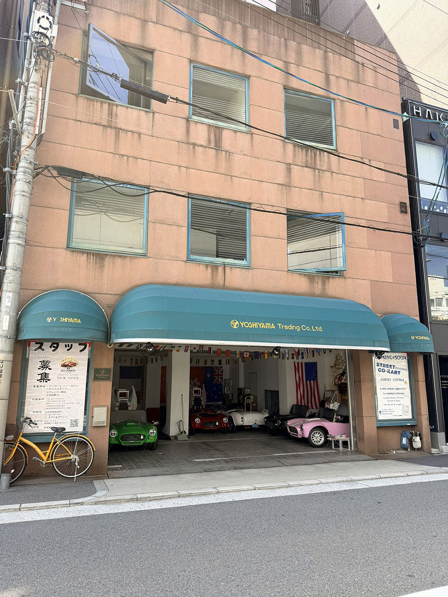
Official Osaka tourism maps treat the Castle area as its own visitor zone, while the park contains separately operated facilities. W Go-Kart Osaka’s map uses Osaka Castle as the route’s defining orientation. The operator does not publish museum entry, park parking, a detailed history lesson or a guaranteed stop as part of the kart specification.
12.6 kilometres signals a broader loop
The distance is useful when a buyer wants a longer geographic sweep around a single historical subject. It should not be converted into average speed by dividing it by 48 minutes because map time and road operation do not establish continuous movement. The site also publishes no speed figure for comparison.
48 minutes belongs inside the approximately one-hour service
The difference between mapped time and service label should not be called “unused time.” Reception, briefing and return are real service stages. The Castle-loop day guide shows how to place the experience before a separate park visit without promising an exact finish.
The Castle name does not specify every sightline
No turn-by-turn road, direction of approach, seconds of visibility or photo position is published. The current media library also lacks a confirmed Castle-route action photograph. A buyer should use the name as genuine route orientation while leaving view details to the live guided drive.
The city route specification supports a night-district decision
The city map gives more named district information than the Castle map. That allows a visitor to understand its sequence through the wider Minami and Shinsekai context. Official area maps confirm those are recognizable Osaka visitor zones, but they do not define W Go-Kart Osaka’s exact roads.
8.9 kilometres concentrates several urban identities
Amerikamura, Shinsaibashi, Dotonbori, Namba/Nipponbashi, Ebisucho and Shinsekai/Tsutenkaku appear as orientation names. The route does not include time to shop, eat or enter the tower. A shorter mapped distance can still contain more named district changes, which is why kilometres alone cannot rank it below Castle.
46 minutes does not allocate time by district
The website does not state how long the group spends in Namba or near Tsutenkaku. A calculation such as “seven minutes per area” would invent precision. Traffic and guide operation affect rhythm. The city-map literacy guide explains how to use names without turning them into stops.
The night recommendation has authentic first-party imagery
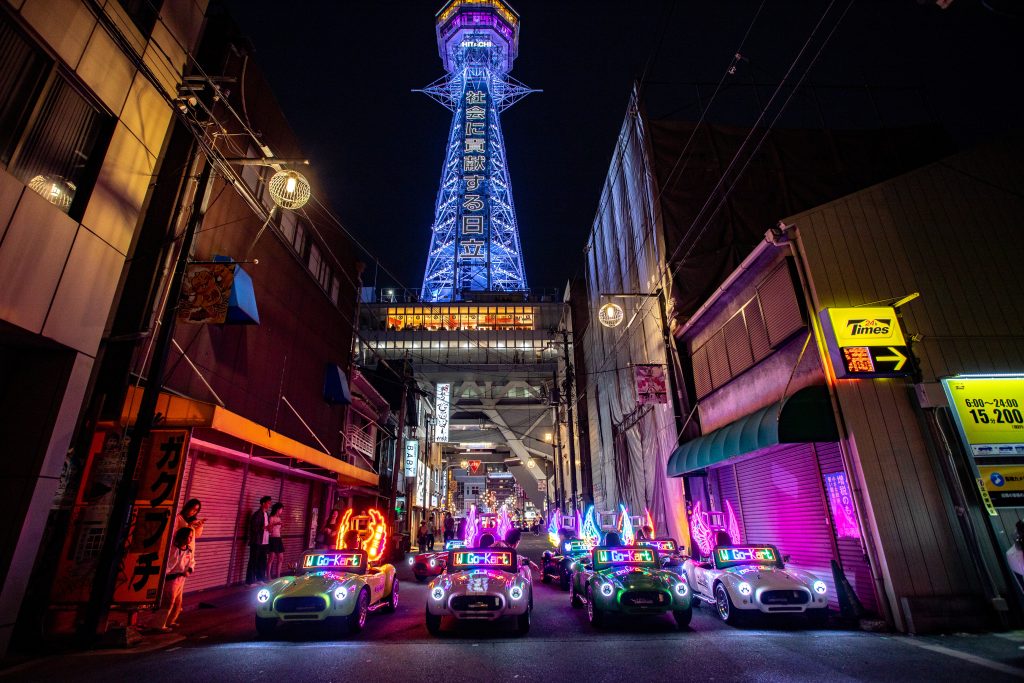
W Go-Kart Osaka publishes a real photograph of several electric karts with the illuminated Tsutenkaku area. This evidence supports the night setting. It does not guarantee the same group size, traffic gap, weather, lighting or camera position. An image confirms that a setting has occurred, not that it will be repeated identically.
Calculated differences need careful labels
The 3.7-kilometre difference is arithmetic, not a road test
Subtracting 8.9 from 12.6 produces 3.7 kilometres. This is a transparent calculation from approximate map values. It does not establish energy use, physical effort, difficulty, exposure or duration. No vehicle specification or controlled test is available to support those conclusions.
The two-minute difference is too small to drive the route choice
Using approximate source values, Castle is depicted two minutes longer. The difference is not an exact measurement uncertainty or a performance margin. A buyer gains more by choosing historical daytime context versus southern night context than by attempting to save two map minutes.
Distance divided by time should not be published as route speed
A mathematical quotient would look precise but be misleading. Map time can include variable road behaviour and does not say the kart moved continuously. W Go-Kart Osaka publishes no speed promise. Driver attention should stay on the guide, signals and pedestrians rather than achieving an inferred average.
Seven route specifications remain undefined on the website
The site does not publish exact turn-by-turn roads, guaranteed landmark visibility, a stop list, photo-stop duration, guide commentary, average or maximum speed, or a route-specific group capacity. It also does not say the map is immune to operational change. These fields should remain unknown instead of being filled from competitor pages or assumptions.
An undefined stop list protects against false attraction promises
The homepage says stopped photo moments are available and guides may help, but the map does not identify them. A guest should not buy on the assumption of parking at Castle, Dotonbori or Tsutenkaku. Attraction entry and walking visits are separate plans.
An undefined road list prevents self-navigation
The guide leads the group at all times. A detailed street sequence is unnecessary for the buyer’s route choice and could become stale. The customer should not use a personal map to branch away. Select the identity before departure and follow current guide direction during operation.
An undefined capacity cannot be inferred from the guest selector
The booking form offers one through seven guests, while the homepage says tours have limited participant numbers and advises checking availability. This is not a published fleet size or guarantee that seven drivers can take every start. Availability remains a live commercial field.
Route data and package data meet at the booking decision
From 10:00 through 16:00, the published price is JPY 7,000 and aligns naturally with the Castle/day recommendation. Starts at 17:00–19:00 cost JPY 10,000. The 20:00–22:00 Night Experience costs JPY 13,000 and aligns with the city/night recommendation. These are commercial bands, not changes to the map values.
Guide, insurance and costume are common service constants
Every band includes approximately one hour, guide, insurance and costume. Coffee, speaker and 360 camera are separately priced before 20:00 and included at night. The price specification guide separates those package fields from route geography.
Documents remain a route-independent requirement
Every driver needs an accepted original set, whether choosing 12.6 or 8.9 kilometres. A Japanese licence, the complete original Geneva IDP path, or the accepted foreign-licence/authorized-translation path can qualify under current rules. The site publishes no passenger alternative for someone who cannot drive.
Three buyers should record the same specifications differently
A specification becomes useful only when it resolves a real decision. The data-minded traveller, photographer and schedule planner can all read the same two maps, yet each needs to mark a different boundary. These examples do not add facts to the maps; they show how to avoid the most tempting false inference for each use.
The data-minded traveller should preserve the word “approximately”
This buyer writes “Castle: approx. 12.6 km / 48 mapped minutes” and “City: approx. 8.9 km / 46 mapped minutes.” They do not round the source into an exact distance or build an average speed column. If they calculate the 3.7-kilometre and two-minute differences, they label both as arithmetic from approximate operator values. That record remains useful even when public-road flow varies.
The photographer should record setting and non-guarantees together
This buyer notes “Castle/day orientation; no confirmed route-action image in the current media set” and “City/night orientation; authentic Tsutenkaku-area image available.” Next to both, they write “no exact stop, sightline or repeatable frame published.” The 360-camera option or inclusion is a package field, while the no-phone rule and staff direction govern capture. That prevents imagery from silently becoming a route specification.
The schedule planner should separate map time from calendar time
This buyer records a ten-minute early arrival, document check, briefing, approximately one-hour service and travel after the Shinmachi return. They never place an onward train at start time plus 46 or 48 minutes. The route figure helps compare the loops; the full calendar envelope protects the trip. If a connection is fixed, the planner chooses an earlier start rather than asking approximate map data to behave like a transport guarantee.
Shared specifications keep the comparison from becoming exaggerated
Both routes use electric karts, guide leadership, public roads, the same reception and the same approximate service length. Both require accepted originals and a ten-minute early arrival. Both can be affected by weather and live traffic. These common fields matter because they prevent a visitor from treating Castle and city as entirely different product classes.
The route changes the city subject, not the legal threshold
A shorter map does not need fewer documents, and a daytime recommendation does not relax road rules. Each person drives independently behind the guide. The party should complete the same eligibility and clothing preparation before debating geography, because no route data can rescue an incomplete physical licence set at reception.
The same Shinmachi address closes both technical records
A route sheet should end with 3 Chome-5-2 Shinmachi as well as begin there. Adding that line prevents Castle, Namba or Tsutenkaku from becoming an assumed finish. It also forces the planner to attach onward transport to the correct point. The operator’s station walk estimates help reach the base; they are not part of either route’s 12.6- or 8.9-kilometre measurement.
Select an Osaka go kart route from published facts
Choose Castle for the broader, historical, daytime-oriented map. Choose the Tsutenkaku city route for the shorter, district-dense, night-oriented map. Do not select based on inferred speed, guaranteed photographs or a two-minute saving. Use the booking form after the party aligns route, start, eligibility and package.
Customer cancellation is free until 48 hours before departure. Inside that boundary it is non-refundable, and rescheduling depends on availability. Unsafe-weather operator cancellation follows the current refund or no-cost reschedule terms. Read the commercial disclosure before treating a map as a fixed travel connection.
Specification information checked on 24 August 2026: route names, approximate distance/time, recommendations, city labels, service length, start/return, starts, prices, inclusions, documents and policies were checked on W Go-Kart Osaka pages. Official tourism supports only broad area identity. Arithmetic is labelled as calculation. No speed, exact road, view, stop, commentary, district duration, capacity or finish is claimed.
The best route specification is not the one with the biggest number; it is the one that answers the visitor’s city objective with the fewest unsupported assumptions. W Go-Kart Osaka publishes two clear identities and enough measurements to choose between them. Use those values honestly, arrive at Shinmachi prepared and let the guide turn a data sheet into the real Osaka road experience.