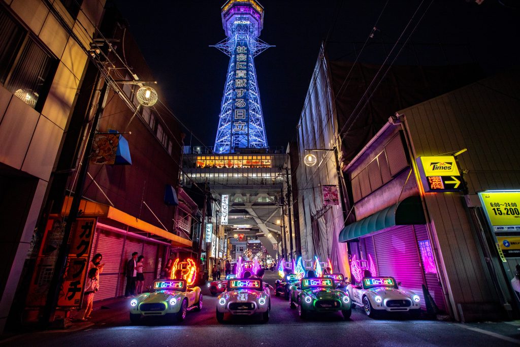
An Osaka street kart route at W Go-Kart Osaka should be chosen by the map’s visual emphasis, not by treating distance as a score. The Castle loop is mapped at approximately 12.6 kilometres and 48 minutes and is recommended during the day. The Tsutenkaku city loop is mapped at about 8.9 kilometres and 46 minutes and is recommended at night. Both are guided electric public-road services starting and returning in Shinmachi.
Choose Castle when one historic area should organise the drive. Choose Tsutenkaku when the desired memory comes from a sequence through or near Amerikamura, Shinsaibashi, Dotonbori, Namba, Nipponbashi, Ebisucho and Shinsekai. Before selecting either, confirm valid original driving documents and enough time to arrive ten minutes early. The operator’s service page carries the current facts, and the booking form connects the route to an available date and start.
Osaka street kart maps answer four questions—and leave others open
The two operator PDFs identify route shape, prominent place names, a mapped distance and a mapped duration. They help a buyer understand whether the drive points towards the Castle area or builds through the southern city. They do not create a contractual timetable for every signal, a guaranteed stop list or permission to leave the guide.
The 12.6-kilometre Castle loop is not 12.6 kilometres inside the park
The route begins at Shinmachi, travels towards the Osaka Castle area and returns. Its approximately 12.6-kilometre label belongs to the whole mapped loop. It should not be read as distance within Osaka Castle Park or as a promise that the kart enters every road around the landmark.
Osaka’s official visitor guide describes Osaka Castle Park as a large central park containing historic buildings and seasonal landscapes. It separately describes the Osaka Castle Museum as an attraction with admission. W Go-Kart Osaka’s route is a public-road drive, not park or museum entry. A visitor wanting an interior visit should schedule it separately.
The 8.9-kilometre city loop earns variety through named districts
The city route’s shorter mapped distance does not make it a reduced version of Castle. Its map names a chain of southern districts and landmarks, and the operator recommends the loop after dark. The visual concept is cumulative: each commercial area contributes to the transition towards Shinsekai and Tsutenkaku before the return.
Osaka’s official guide identifies Dotonbori as a major Minami shopping and entertainment district and Tsutenkaku as a landmark tower in Shinsekai. These sources explain the district context; they do not mean the tour includes admission, dining or a fixed photo below the tower.
A two-minute mapped difference does not make the routes interchangeable
Forty-eight minutes and forty-six minutes are close on paper, yet the route geography is substantially different. The Castle map covers about 3.7 more kilometres while showing only about two more minutes. A customer should not divide distance by time to claim an average speed, performance level or faster route. The website publishes no speed specification, and real roads include different signals and live conditions.
The useful conclusion is narrower: both maps sit inside the operator’s approximately one-hour experience, so duration alone should not decide between them. Landmark pattern and recommended light carry more meaning than the small time difference.
The same caution applies to intersection count, waiting time and the portion of a landmark visible from the kart. None of those values is specified on the public route material. A buyer can compare the lines and named areas, but should not reverse-engineer a street-by-street performance promise. This protects the decision from false precision: the maps are detailed enough to distinguish the two sightseeing concepts and deliberately not a guarantee of how every future departure will meet Osaka traffic.
Choose an Osaka street kart loop by landmark pattern
The Castle route has a single dominant anchor. The city route distributes attention across several districts. This distinction remains useful even when a visitor is equally interested in history and nightlife, because the surrounding Osaka itinerary can reveal which pattern is missing.
| Map-reading question | Castle loop | Tsutenkaku city loop |
|---|---|---|
| Mapped reference | About 12.6 km / 48 min | About 8.9 km / 46 min |
| Geographic emphasis | Osaka Castle area | Amerikamura to Shinsekai sequence |
| Recommended light | Daytime | Night |
| Strong itinerary fit | Day needs a historical anchor | Evening needs connected southern districts |
| Map does not promise | Park entry or museum admission | Dining, landmark admission or Namba finish |
The table should be read from the middle outward. Geographic emphasis and recommended light identify the experience; distance and time then confirm that both fit the same approximate service window. The final row prevents attraction expectations from leaking into the tour. A visitor who starts by comparing kilometres may select a longer line but miss the night districts actually wanted, while a visitor who starts with the landmark pattern is more likely to choose a route that complements the trip.
One historic anchor suits a day already rich in commercial streets
A traveller staying in Namba, eating around Dotonbori and shopping in Shinsaibashi may already have the city route’s districts in the itinerary. The Castle loop can broaden the day’s visual range. It allows the historic area to become the kart experience’s centre without claiming that the drive replaces walking through the park.
This buyer should favour a 10:00–16:00 start, the period W Go-Kart Osaka associates most naturally with daytime. Seasonal sun, cloud and weather still vary, so a specific façade angle or lighting condition cannot be guaranteed.
Several southern districts suit a day dominated by formal attractions
A visitor whose Osaka day already includes the Castle, a museum or a park may want a visibly different final activity. The Tsutenkaku city loop turns the progression through Minami and Shinsekai into the point of the drive. Illuminated karts strengthen that identity after dark.
The route is especially coherent when the group values a moving night sequence more than an extended stop at one place. A person whose main goal is dinner in Dotonbori or entry to Tsutenkaku should schedule those separately and remember that the guided loop returns to Shinmachi.
A mixed-interest couple should choose the missing perspective
Suppose one traveller prefers historic scenery and the other prefers nightlife. Counting place names favours the city loop without resolving the disagreement. Instead, list what both have already planned. If Dotonbori and Shinsekai appear elsewhere, Castle adds more contrast. If the trip already contains several temples, museums and daytime landmarks, the city loop adds a new visual language.
The experience-mood comparison expands that couple decision. Here the map itself supplies the initial evidence: one anchor versus a connected district sequence.
Public-road conditions keep both route maps flexible
W Go-Kart Osaka is not a track operator. The guide leads electric karts through ordinary traffic, and every licensed visitor remains responsible for signals, pedestrians and surrounding vehicles. A route line communicates direction; it does not reserve the street for the group.
Traffic can change the rhythm without changing the chosen loop
A signal may divide the group or congestion may alter the time spent in one section. The driver should follow the briefing and traffic law rather than rushing to recover visual contact. Osaka Prefectural Police provides visitor road rules for the wider environment.
No buyer should demand a repeat pass, illegal stop or route diversion because one view was brief. The guide must respond to live conditions. That limitation preserves the actual nature of street sightseeing.
Photography belongs to approved moments rather than map landmarks
The operator prohibits taking photos while driving. Use safe stops and guide assistance. A 360 camera is optional in earlier bands and included in the Night Experience, but the website does not publish its model, file count, delivery method or a guaranteed background.
A route map showing Tsutenkaku does not promise a staged portrait under the tower, just as the Castle line does not promise a particular gate. Choose the scenery you want to move through, not a single image the operator has not guaranteed.
Unsafe weather can suspend either map
Light rain may allow operation and rain gear may be available. Severe or unsafe conditions can cause the operator to cancel or reschedule. Wet surfaces and visibility can change the drive, and the customer should not use the map as an argument that a route must proceed.
Price bands add package context without rewriting the maps
Morning and afternoon starts run hourly from 10:00 through 16:00 at JPY 7,000. Evening starts at 17:00, 18:00 and 19:00 cost JPY 10,000. Night Experience starts at 20:00, 21:00 and 22:00 cost JPY 13,000. Every band includes the approximately one-hour service, insurance, guide and costume.
Earlier starts separate the core route from optional extras
Coffee costs JPY 500, a speaker JPY 500 and a 360 camera JPY 1,000 in the morning/afternoon and evening bands. A buyer can choose the Castle or city geography without assuming every extra is necessary. The route decision should remain tied to scenery and time, while equipment follows actual use.
The Night Experience bundles extras around the city-light identity
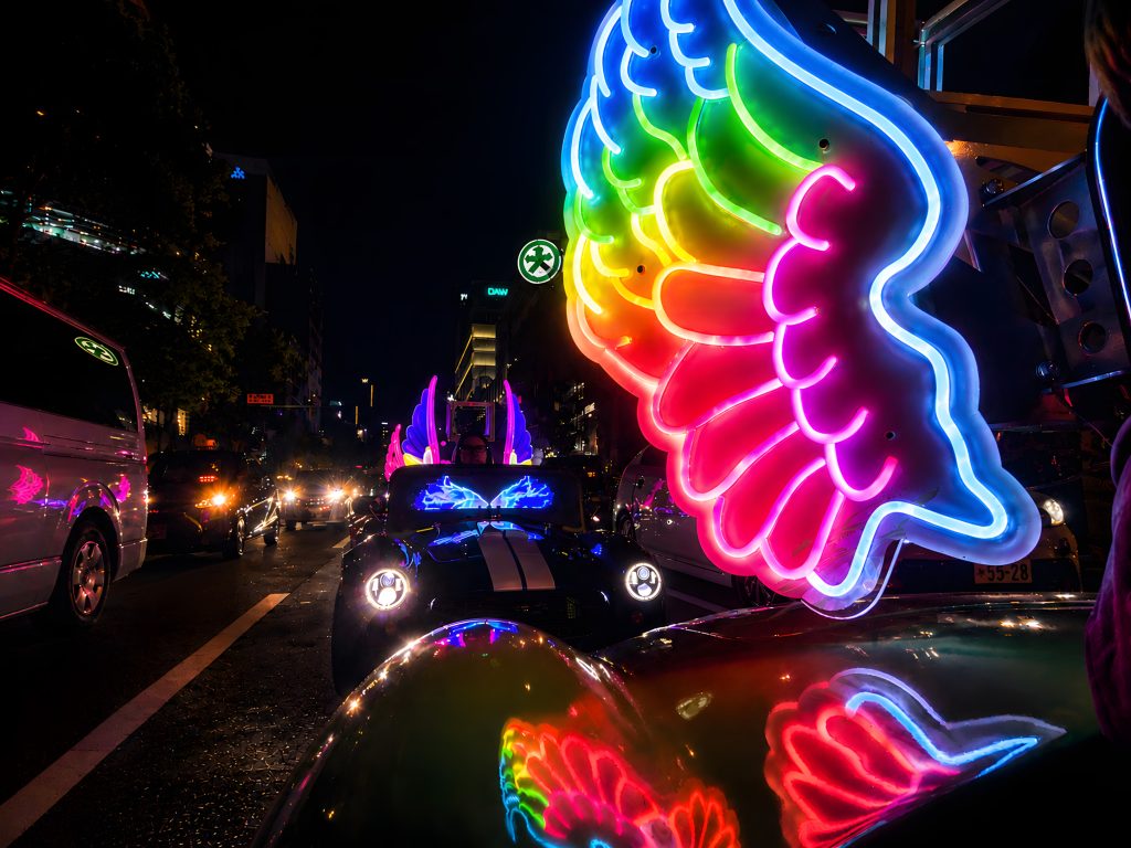
At 20:00–22:00, coffee, speaker and 360 camera are included. The package supports the after-dark city route, but does not change public-road rules, promise a photograph or turn the map into a timetable. The inclusions guide separates core service from equipment, and the time-band guide explains how each departure affects the surrounding itinerary.
Both routes require the correct physical driving documents and arrival ten minutes early at 3 Chome-5-2 Shinmachi. Customer cancellation is free up to 48 hours before departure; inside 48 hours it is non-refundable and rescheduling depends on availability. Operator cancellation for unsafe weather offers a refund or no-cost reschedule under the current terms.
The booking form asks for name, email, date, time, a guest count from one to seven and the selected tour route. That selector records what the customer requests; it does not turn the route map into proof that seven karts are available or that all seven people may drive. Each intended driver needs an accepted individual document pathway. A group should therefore settle both the map choice and the real number of qualified drivers before treating a displayed departure as its final plan.
This order also prevents an attractive route line from hiding a basic service mismatch until the group reaches Osaka.
Route facts checked on 24 August 2026: mapped distance/time, named districts, day/night recommendations, guided format, packages, documents, photography, address, weather and cancellation terms were checked against W Go-Kart Osaka’s current material and PDFs. Landmark context uses Osaka’s official visitor guide and road context uses Osaka Prefectural Police. No average speed, admission, exact stop, repeat pass, landmark photo or fixed duration is claimed.
Read the two maps as different stories, not competing scores. The 12.6-kilometre Castle loop gives a daytime drive one historical centre; the 8.9-kilometre Tsutenkaku loop lets several southern districts accumulate into a night sequence. The two-minute mapped gap is too small to make duration the deciding factor. Choose the geography that adds the missing perspective, then let the guide and live Osaka roads determine how the published loop unfolds.